9/9/17
30 miles
184.6 miles hiked
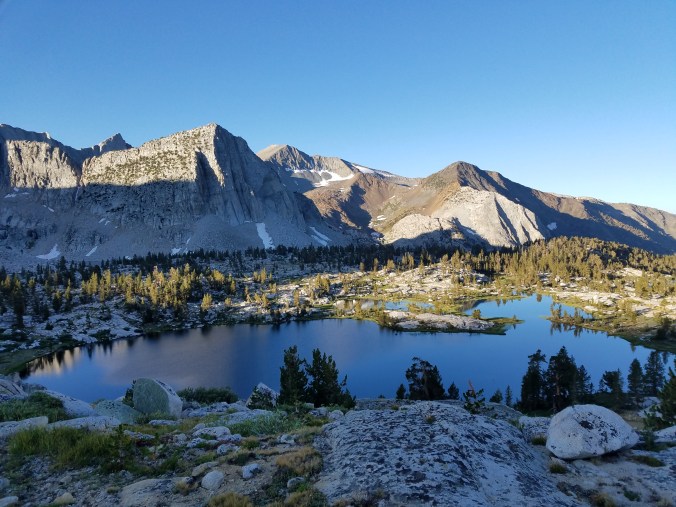
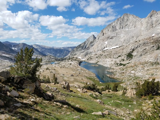
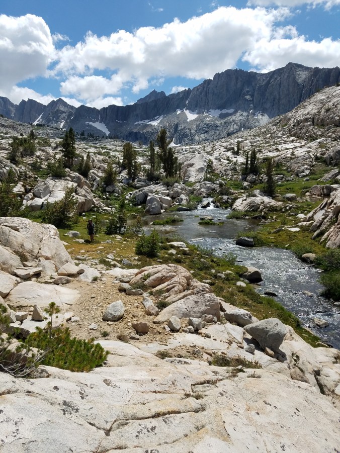
Getting up to Dumbbell Pass in the morning is chill- just some frosty grass and slabs- but once on top we find a long snowfield headed down, and since it’s early in the morning the snow hasn’t yet softened. The snow is too icy for our One Microspike Each trick so I take the set of microspikes while Kodak goes around the snowfield on some massive talus. It’s fun to clomp down the steep, icy snow on my magic spike feet- what would’ve been a skating rink becomes a casual walk and soon both Kodak and I are at the ethereal blue of Dumbbell Lakes, cooking late breakfast next to the stream. As I eat my mush with its generous helping of olive oil I will it to turn into fuel that lasts for hours and hours. I feel like a car whose gas guage is on E but the gas station is still thirty miles away and maybe I’ll make it there?
.

.
.
.
.
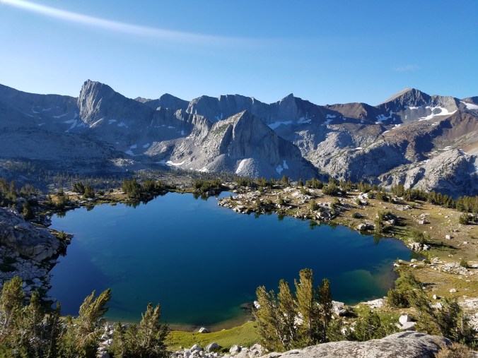
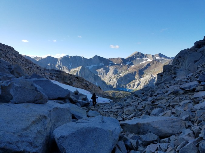
Another nice grassy ramp leads us up to Amphitheater pass, where we find… a snow cornice. Another impassible overhanging cliff of snow. Of course. To the left of the cornice is some very steep dirt and talus, and we ease ourselves down this, and it feels like we’re moving about two inches per hour. We continue at about this pace over truck-sized talus far above the lake, whose shore we’re avoiding in order to steer clear of… talus. A boulder rumbles as I pull myself up onto it, and I accept that my leg is about to get broken, but then the boulder goes silent again. This happens multiple times per day out here. What are routes but a large collection of such moments. And yet I make my way. Despacito.
cornice
.
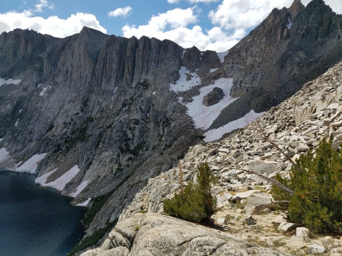
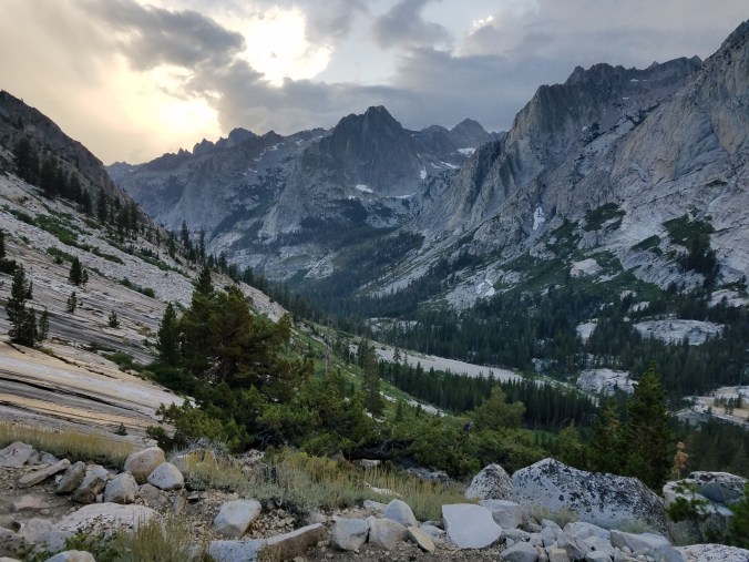
That inverted white triangle on the ridge is Amphitheater pass and the cornice we just came over
The boulder-chunks turn to slab-chunks and we’re walking on shapes some more crushing flowers beneath our feet hopping over wild rivulets of water butt scooting and jumping and making our way down, down.

.
.
Down alongside Cataract creek, where there is supposed to be a use trail. Kodak finds it but I do not and we make our own ways around a cliff and once our lines rejoin we regale each other for half an hour with tales of those forty minutes spent apart. The use trail leaves its corporeal body and we are deposited in a burn snarling with undergrowth through which we push until we reach Palisade creek, on whose opposite bank is the motherfucken John Muir Trail.
We sit in a trampled spot of dirt next to the JMT and eat peanuts and take off our shoes. A man comes walking up the trail towards us. He’s got a beard and looks to be about twenty-five.
“Is this the start of the golden staircase?” he asks.
“I’m not sure,” I say. “What’s that? We came from over there.” I wave vaguely at the forest.
“The golden staircase climbs 1,500 feet in two miles,” says the man. “It’s the hardest part of the whole JMT!” He takes off his hat, wipes his face with it, and then he is gone.
I look at Kodak and start to giggle. Soon we are both laughing, and then we cannot stop.
We realize then that we’re twenty miles from my van, and all of these twenty miles are on trail, including a four thousand foot climb up and over Bishop pass. We’ve already done ten miles over two passes cross country, Dumbell and Amphitheater, with who knows how much elevation gain and loss. It is four p.m. We have three hours of daylight left.
I think of the small handfuls of food still in my food bag. If we make it back to the van tonight instead of tomorrow, I can gorge myself on my two remaining dinners. If we hike all the way back to the van tonight, I won’t be as hungry.
A thirty mile day on this route, though. It that even possible?
I put in my headphones and crush the seven miles on the JMT to the ranger station, where I find the junction to the Bishop Pass trail. At the junction I sit on a rock in the rain and eat my very last bar. I feel fucking incredible.
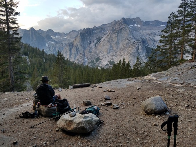
We mash the switchbacks up towards Bishop pass as the sun sets in a glory of pink clouds, remembering walking these same switchbacks our first day on this route.
When we get to where we camped that first night we make a hurried dinner in the last of the light. Mine is really two dinners, and I dump the remainder of my olive oil into it.
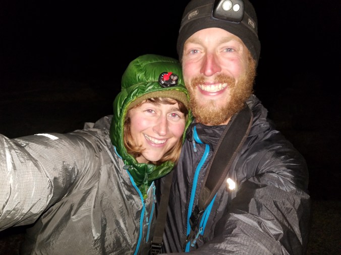
The dinner warms my insides and keeps morale high as the sky turns to a million stars and the air, as we gain in elevation, turns to ice. It feels like fall is here and the weather in the High Sierra is turning at last. I think of that song that was always on the radio when I was in high school. Closing time, you don’t have to go home but you can’t stay here. At one point Kodak has us stop and take a long-exposure star photo together which requires me to stand still for a few moments and afterwards I’m so cold I can’t seem to get warm again. We hustle up the icy trail as fast as we can in the dark, the batteries in both our headlamps near dead, and soon we reach the snow patches that are Bishop Pass. Now that we’ve reached the top, and we only have to go down, exhaustion hits us, and time slows nearly to a standstill. The path is rocky but clear and the air warms as we descend but I’m so tired I’m delirious. I haven’t had any water in a while because I haven’t wanted to stop and treat any and my tongue feels heavy in my mouth. We’re so hungry, but neither of us has any food. We stumble down the trail, occasionally shouting encouragement at each other. The black silhouettes of the mountains echo our encouragement back.
we’re gonna make it!
We only have a handful of miles left but these miles stretch out until they are everything, the entire world, and I feel empty inside, a shell of a human being propelling itself forward. And then we’re at a tiny footbridge and then the parkinglot, and still we have a mile and a half on pavement to get to the van, which is parked in the overflow parking down near Parchers resort. This 1.5 mile roadwalk is unbelievably long, the longest stretch of earth we’ve covered all day. We reach the van at midnight and climb inside. I’m too sick with hunger and dehydration to eat, too cold to ever be warm again. I force myself to eat some chips and put on extra layers and burrow into my sleeping bag until I stop shaking, relieved and elated and exhausted, grateful for this adventure to be over, and so grateful for it to have happened at all.
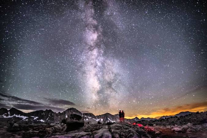
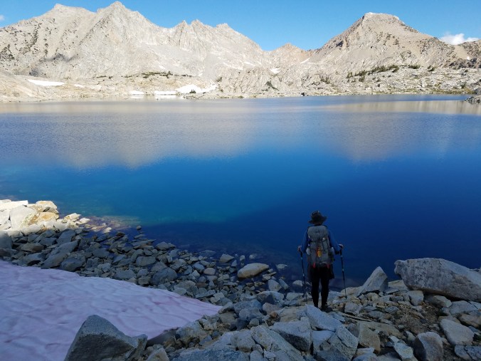
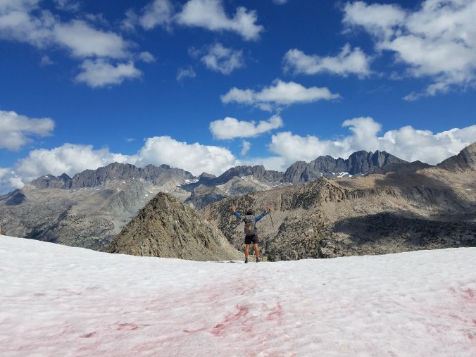
This photo of Kodak’s really sums up our final day, and the glory of the whole route, really
Post trail thoughts:
I loved the KCHBR. It was enchanted, magical, and otherworldly, and felt incredibly remote, especially for how accessible it is. It was also the most consistently difficult trail I’ve done, as far as how many miles one is able to cover each day and how many obstacles one must problem solve around, and I learned a lot from it. I also gained a great deal of confidence from the route- I feel like now that I’ve hiked cross-country in the high sierra, there isn’t anything I can’t walk on. If I did the route again, I would bring a complete set of microspikes, I would send myself a box in Lodgepole, and I would definitely attempt King Col. I would probably still hike it as a loop, because that was really fun and made the hike longer that it would’ve been normally, and leaving a car at Bishop Pass was logistically simple.
11/10, would walk over all that talus again. Thanks Skurks!

You must be logged in to post a comment.