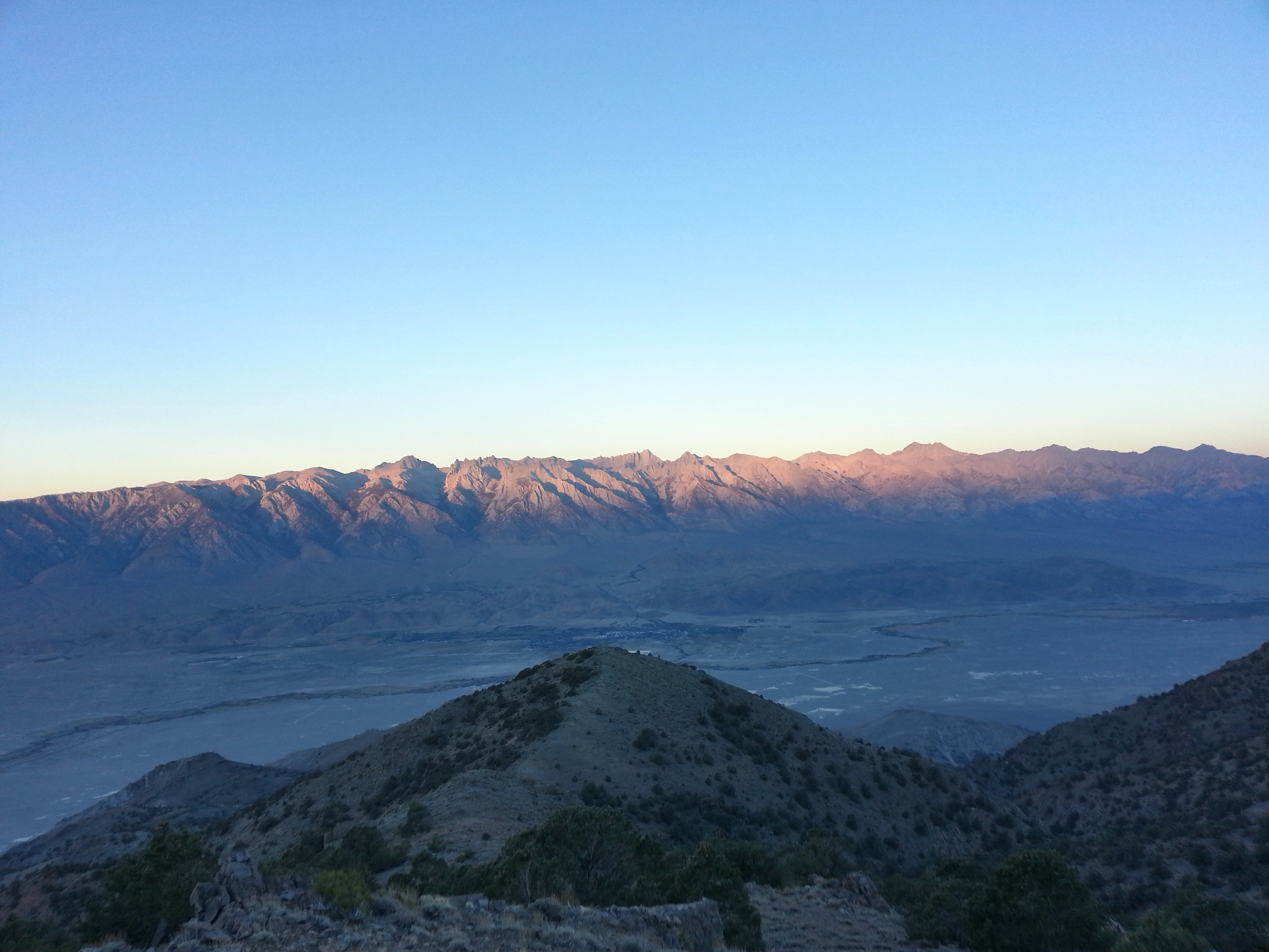
Morning light on the High Sierras, as seen from the crest of the Inyo Mountains. Lone Pine is the patch of green in the valley.
(In the first week of October, 2014, I set out to hike the Lowest to Highest Route with NotaChance and Orbit. This is the final installment of my trip report. For technical information on this route, go here.)
—————-
Oct 7
22 miles
At six a.m. I wake after a single perfect, flawless nights’ sleep and begin to crow the lyrics to Celine Dion’s “My Heart Will Go On” into the still darkness. This is our agreed-upon alarm clock- my singing voice is beyond awful, so it’s really, really funny. It’s a joke that started when I used the song to wake Jess and Lia for our four a.m. summit of Mt. Adams- another hit was me singing Miley Cyrus’ “The Climb”.
“Your version is better than Miley’s,” said Lia, who is a musician, as we struggled up the steep white snow.
“Thank you,” I said. “I know.”
Now Jess boils instant coffee for everyone in her jetboil while the sky lightens to a washed-out shade of blue-black and then empties entirely, that single, colorless moment before the liquid sun spills over the mountains. The coffee is good and I feel fucking amazing- I actually had a real full uninterrupted nights’ sleep and now the world is suffused with goodness, possibility and promise. Things are good, things will get better! Mountains! Magic! Sunrise! Can you actually even believe that there is something instead of nothing!
Directly after Burgess Well the route leaves the rutted jeep road we’ve been following since our cache and begins to cut down the mountainside, towards Long John Canyon. There’s a “faint cairn trail,” which means we’re cutting back and forth like rabbits on the gravelly slope, whooping with joy when we find a cairn.
“A cairn! A cairn! ERMAHGERD CAIRNS!”
It’s cold but the air is slowly warming and below us is the flat Owen’s Valley, with Lone Pine on the far side a cluster of little trees, and then the High Sierra rising up catching the first rays of light. The cairns are small and often toppled and I fix a few, which makes me feel good, and try and imagine who comes up here, who made this route in the first place. I picture a wizened man running his fingers over an old topographical map, driving his 4-wheeler across the valley in a cloud of dust, hiking up here to watch the sunset. Gathering the rocks from the hillside to build all these cairns.
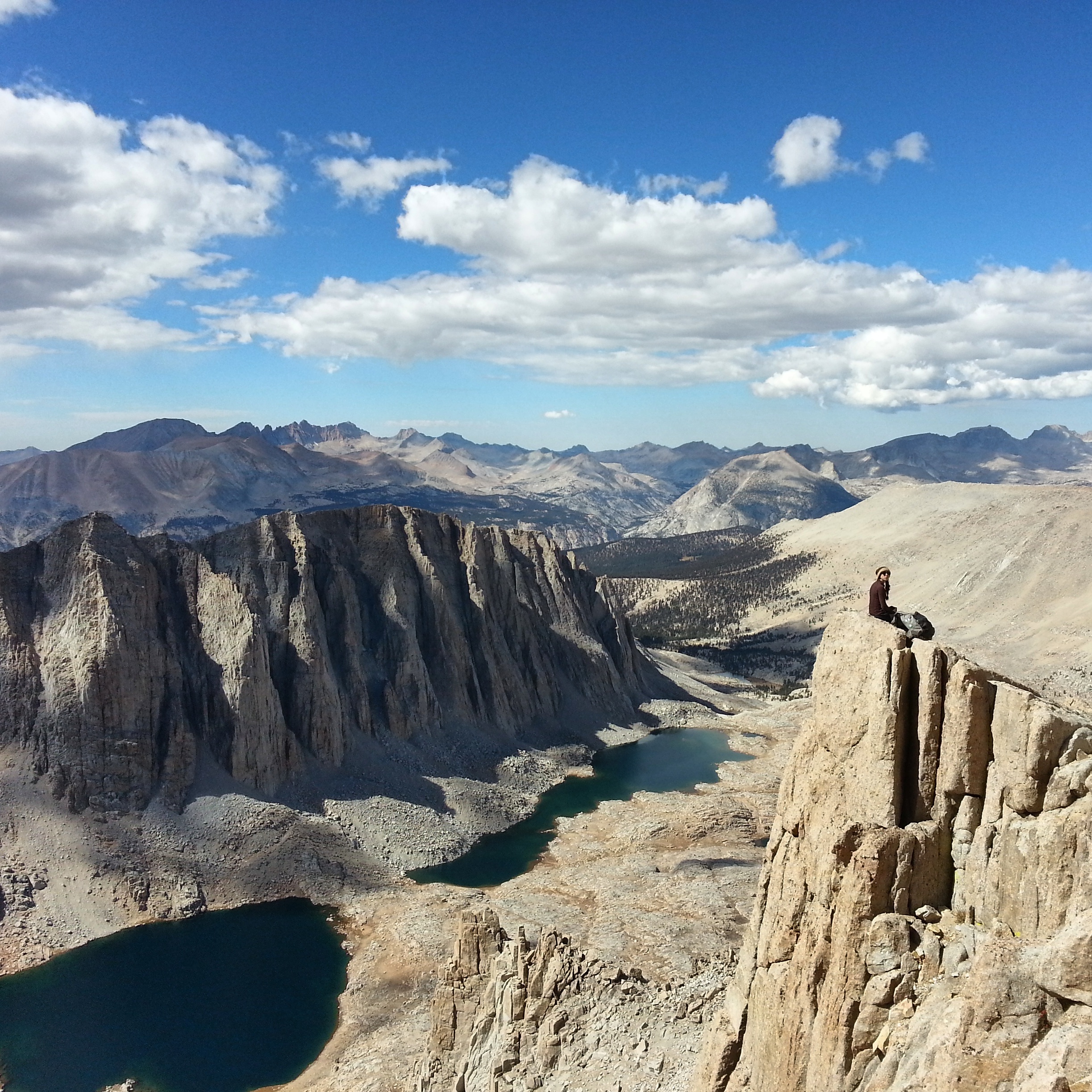
sass chance
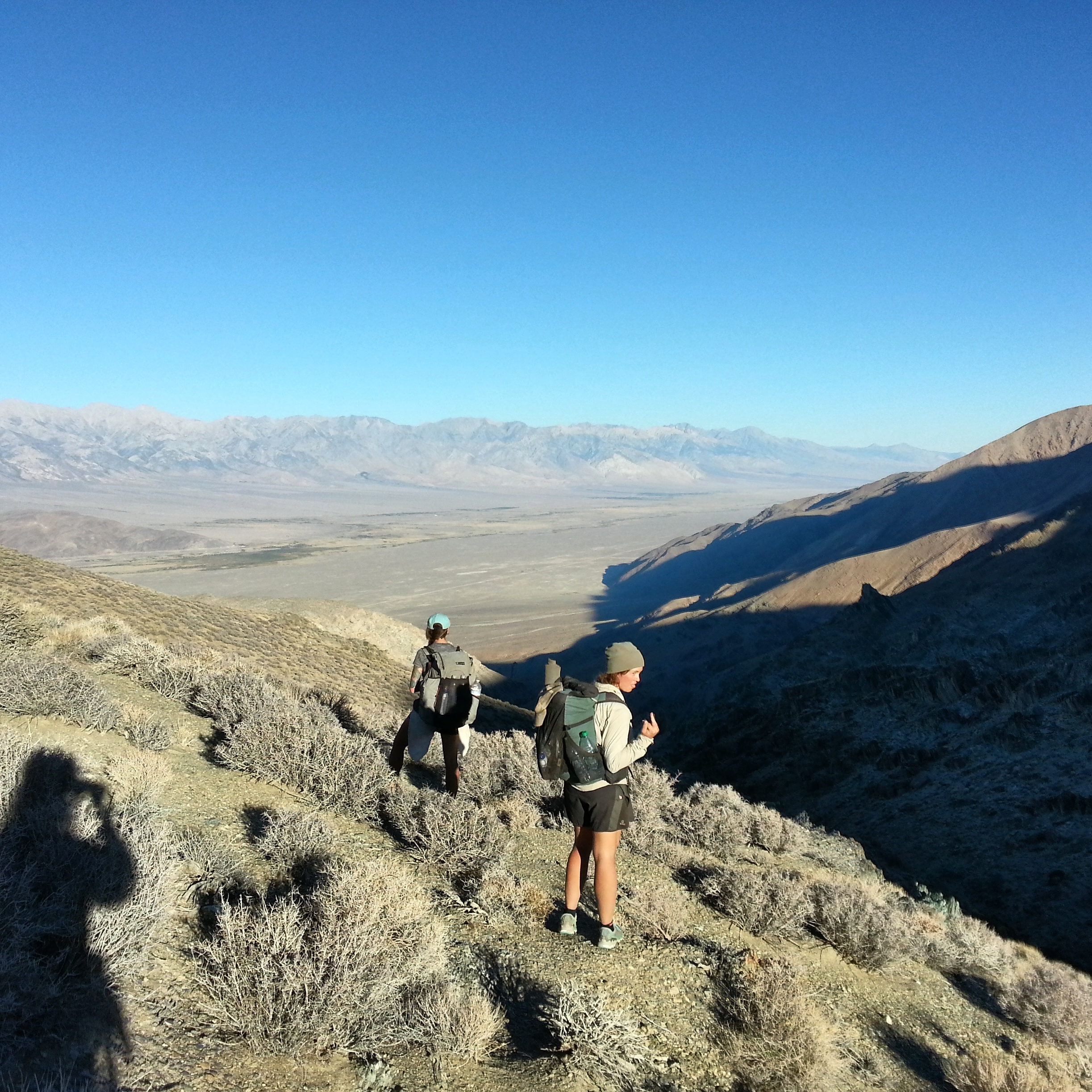
At one point Long John canyon, the wash that we’ll follow to get out to the valley, is far below us, and the maps are telling us to simply go “down”. Now commences the sport known as “screeing”, or skiing on scree- jogging down the steep, crumbled shale that leads to the canyon. I am not brave about this sport, and I slide on my butt a lot. By and by we are deposited in the canyon at a large cottonwood tree, standing leafy and miraculous in this cathedral of dirt and rock. There is mining detritus around- rusted steel drums, wooden planks, bits of metal. The leaves on the tree rustle companionably. We walk up the canyon to the find the spring there, which may or may not be running- we’d planned on it being dry and when we find it, penned in between walls of rock, it’s just a little wet spot in a patch of moss. You could gather water here but it would take strategery, and lots of Time. Luckily we have plenty of water so we make our way out of the wash, grateful for the cool shade thrown by the high rock walls. Eventually the wash fades into the bright hot open Owen’s Valley and we join another jeep road, this one cutting straight west towards Lone Pine.

Jess / sierras ho!
It’s hot, now, and nearly noon. I only have a few spoonfuls of sunflower butter left but I don’t want to eat that, so I think about the lettuce wraps at Carl’s Jr. in Lone Pine and drink my tepid water. The sky is hot, the valley is hot and open. The road is hot and it hurts my feet. My shirt is wet with sweat and chafey under my hipbelt.
In the middle of the Owen’s Valley is a miraculous oasis- a swath of muggy growth, long green grass, insects flying everywhere. Old fences tilting into the earth. The Owen’s River runs through here, flat and slow. There are signs posted everywhere- PROPERTY OF LOS ANGELES / NO TRESSPASSING / PROPERTY OF LOS ANGELES
And cellphone towers- two big ones rising up like monumental old-growth, surrounded in fencing, saying WAH WAH WAH WAH WAH into the atmosphere. Next to the river, beneath the cellphone towers, is a cluster of junky outbuildings, a sinking trailer, a bunch of horses penned up without any shade.
“Are those horses happy?” I ask Chance. I don’t know about horses.
“Nah,” she says. “They should have shade.”
The sun is so strong, it’s cooking us. Looking down at the ground is painful because the dirt is bright and it reflects the sun back up, into my face. I wonder how the horses must feel. I look up at the cellphone towers. There are children’s toys in the dirt yard in front of the trailer. We walk past the trailer, but it seems to take forever. We walk and walk and walk. I imagine the children watching us, from behind the broken blinds.
Lone Pine grows infinitesimally closer, those surreal green treetops inching towards us, and then I’m crossing the main drag, climbing over the barbed wire fence, pushing through the brush and across the sandy open desert to the back gate of LoveNote’s house, little white board fence swinging open into the dirt yard. Shower’s on and then I’m in heaven, washing the heat and sweat and weariness away. I take off my clothes and rinse them in the water, run a bar of soap over them, twist them out and watch the dark water swirl away down the drain.
Carls Jr. is crowded with teenage girls in monogrammed sweatpants- some sort of highschool sports team. They stare at me while they eat their fries, not hostile but curious. I consume two burgers in record time and refill my giant soda cup with about a gallon of powerade, step back out into the sun. My clothes are already dry from the walk from LoveNote’s house.
Chance and Jess are at the hostel, the bottom floor of which has been transformed, this year, into a gear shop, collapsed into huge overstuffed chairs watching a movie about water privatization that’s playing on the bigscreen TV. I sit down too and immediately my brain turns off. I feel sleepy and bloated with powerade. I shake the ice around in my cup. But wait, what are we doing? We’ve still got to do the roadwalk to Whitney Portal Campground today, right?
A man approaches us. He’s small, wirey, silver-haired, looks like he used to do a lot of rock climbing. His name is Mike, and he asks us where we’re headed.
“Mt. Whitney,” we say.
“You got your permits?” he asks.
“No,” I say. I’m sort of spaced out.
“Ranger station’s a couple miles outside of town,” he says. “That’s where you get your permits. Tell you what, I can drive you there.”
“Really?” I say. Jess and Chance are half asleep, so I go with Mike in his car, which is clean in that way only very, very new cars can be. The backseat is piled with gear, gear is strapped to the roof.
“I live in Toulumne half the year,” says Mike.
“Wow,” I say. I wonder how one “lives” in Toulumne, but I don’t ask. I am once again amazed and overwhelmed by the generosity of complete strangers. Why do people want to help us like this? And they’re always so nice– while I am often tired, distracted, have very little to give.
At the ranger station there’s a relief map of the region that takes up a big part of one room- It has all the mountain ranges and hot desert valleys and I stand over it, pressing the buttons to light up the little strings of lights. Pacific Crest Trail. Death Valley. Los Angeles Water District. I run my finger over the plastic mountaintops, from Badwater Basin to Telescope Peak, down to Panamint Springs and up Darwin Canyon. I look at the Sierras, Mt. Whitney, follow the PCT south to the descent off San Jacinto. I tap the scorching valley of Ziggy and the Bear. All of it, the whole earth is like this. Up and down, folds and hills and long open expanses. What does it mean? Where should I go? What should I do?
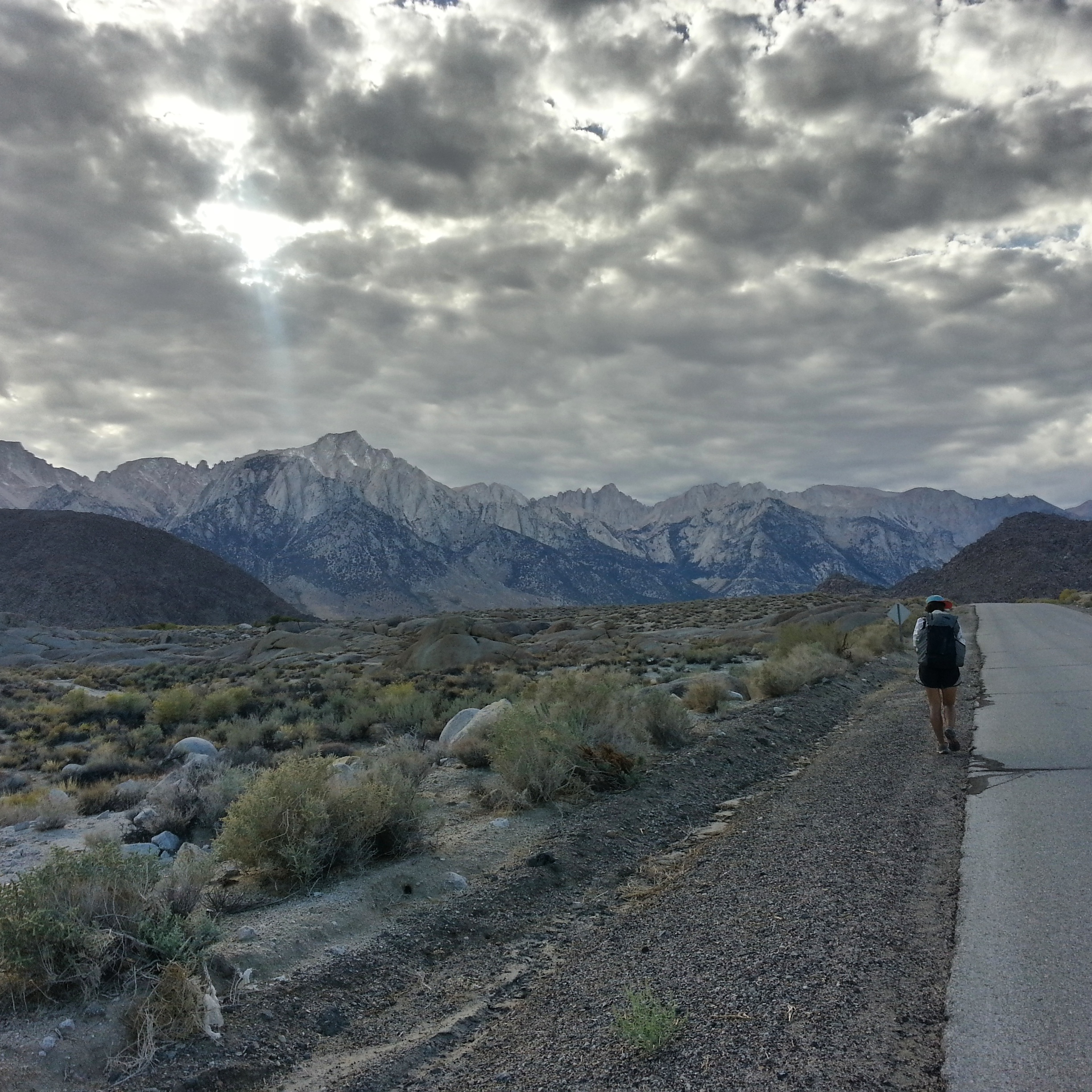
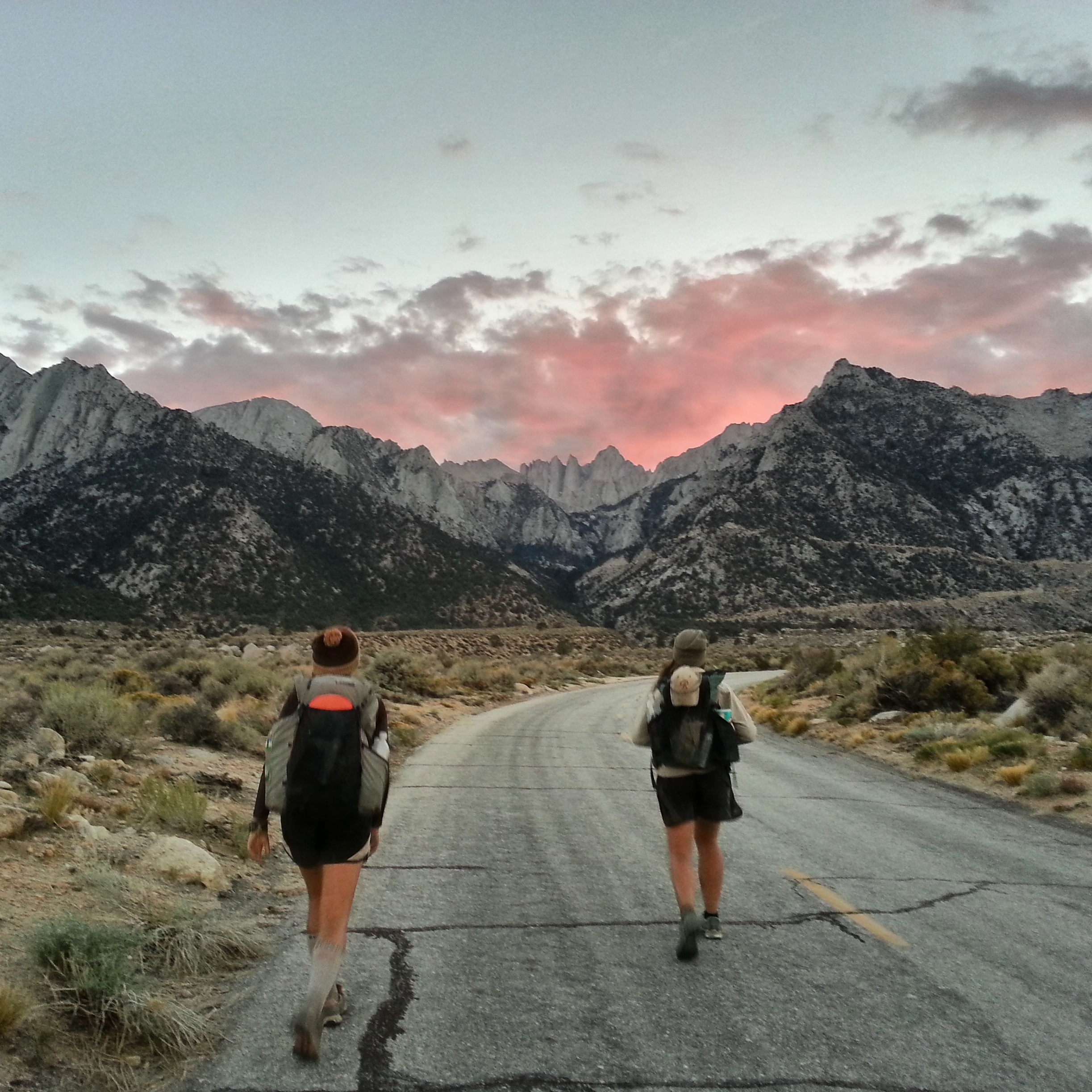
It’s after 4 p.m. when we finally leave Lone Pine to walk the eleven miles to the Whitney Portal Campground. Weather gathers over the peaks of the Sierras as we climb our way towards them on the road- the leftovers, Mike told us, of a storm off the California coast somewhere. The sun drops behind the clouds and begins to set, draping the granite spires in an ethereal pink light.
.
The road climbs and climbs and soon it’s dark, and the sky clears, and the stars wheel above us. Now and then a car comes curving down the mountain and we stop, momentarily blinded, and step aside to watch it pass. I wonder how we look, walking this road in the dark with our packs on. I wish someone would stop and talk to us, ask us where we’re coming from and where we’re going. And I wish I knew the answer to that question.
We watch the moon rise above the Inyo mountains, remember standing over there at dusk the night before. We reach the hairpin where the road turns back on itself and then cuts into a fold of the mountain- you can see this hairpin turn from Lone Pine. “The biggest switchback of your life,” as Chance calls it, and soon we’re swallowed by the granite, pines crowding the road around us, the earth grown softer. All of a sudden we can smell it- the burbling water, the deep loamy soil, the clear thin air. The high Sierras! The mountains rise up on all sides, the stars are sharp and bright and it’s cold, cold, cold.
We reach Whitney Portal Campground and find it to be a dark labyrinth of interconnected campsites, winding its way through the forest and over streams, deserted. The fee for a campsite is, apparently, seventy dollars, but we are small with only our small bedrolls and we find an ambiguous corner next to some bear boxes and unroll our things there, eat a little dinner and cinch ourselves inside our bags against the cold. Before sleep Jess tells us that there will be a full lunar eclipse tonight, in the wee hours. My legs ache and I feel restless, the thin high air gives me a bit of a cough. Finally I drift off.
I wake in a start and sit up in my bag- in the flat spot next to Chance is a black shape, just blacker than the night around it, pawing at the ground.
“Hey!” I say, clapping. “Hey bear!” The bear runs off- it’s the smallest one I’ve ever seen.
“Wha?” says Chance.
“Just a lil feller of a bear,” I say. “He’s gone now.”
“My ibuprofen,” says Chance, picking the small ziploc off the ground. We’d put everything that smelled like anything in the bear boxes but apparently ibuprofen, which is candy coated, attracts them as well. “Dang bear,” says Chance. She walks the ziploc over to the bear boxes, slams it inside, and collapses back into her sleeping bag. I sit up for a while, too wired to sleep. Will the skittish little bear come back? What if the bear, like, touches my face? What if it licks my hand or claws at my backpack? How will I ever sleep after this?
I wake again, from a nightmare, and the moon is red. Blood moon, blood moon. Is this the eclipse? Is this what an eclipse is?
I wake again, startled, and look around me. The moon is gone. The night is eerily dark. I am awake because the moon is gone. I lay back down. Go to sleep, go to sleep, I think. It’s only an eclipse.
———————-
Oct 8
22 miles
Someone’s alarm goes off in the morning and I am awake again, this time in an ordered world without shadows or the strange comings and goings of mysterious beasts. I eat roast chicken and coconut macaroons for breakfast, bought from the little store in Lone Pine with its depressing, half-empty shelves. I’ve got one caffeine gel shot left and I eat half of it and pack the rest away for later. Chance and Jess are pumped, packing up their things and drinking instant coffee. 99 switchbacks to the top of Mt. Whitney, our last eleven miles. This is the moment we’ve been waiting for.
We were hoping for a crowd- it seems silly but I was looking forward to passing lots of day-hikers on the way up, feelings strong and fast amongst the multitudes. But it’s a weekday at the end of the season with the smell of snow on the air, and there’s not really anyone around. In a few days or a week this trail will be covered, buried for everyone except the mountaineers. Now we start to climb, past the quaking aspen in their flame-orange autumn colors and the jeffrey pines and leaping over the small cold streams that bound down the mountain. It is magical here, and I can’t believe that we actually walked up into this wonderland from Death Valley. I am capable of anything, I think. Many small things become one large thing. Many small things become one large thing.
I’m feeling the altitude this morning and I hang back, taking my time. I’m feeling it a lot, actually- my head is pounding and I feel weak. I don’t care, though. I’m climbing up past glittering lakes, the sun shining off the granite, the air so sparkling and pure. I stop often to drink water and eat coconut macaroons. There are a few tents at the lakes on the way up, I pass a couple of people. Mostly, though, I have the trail to myself.
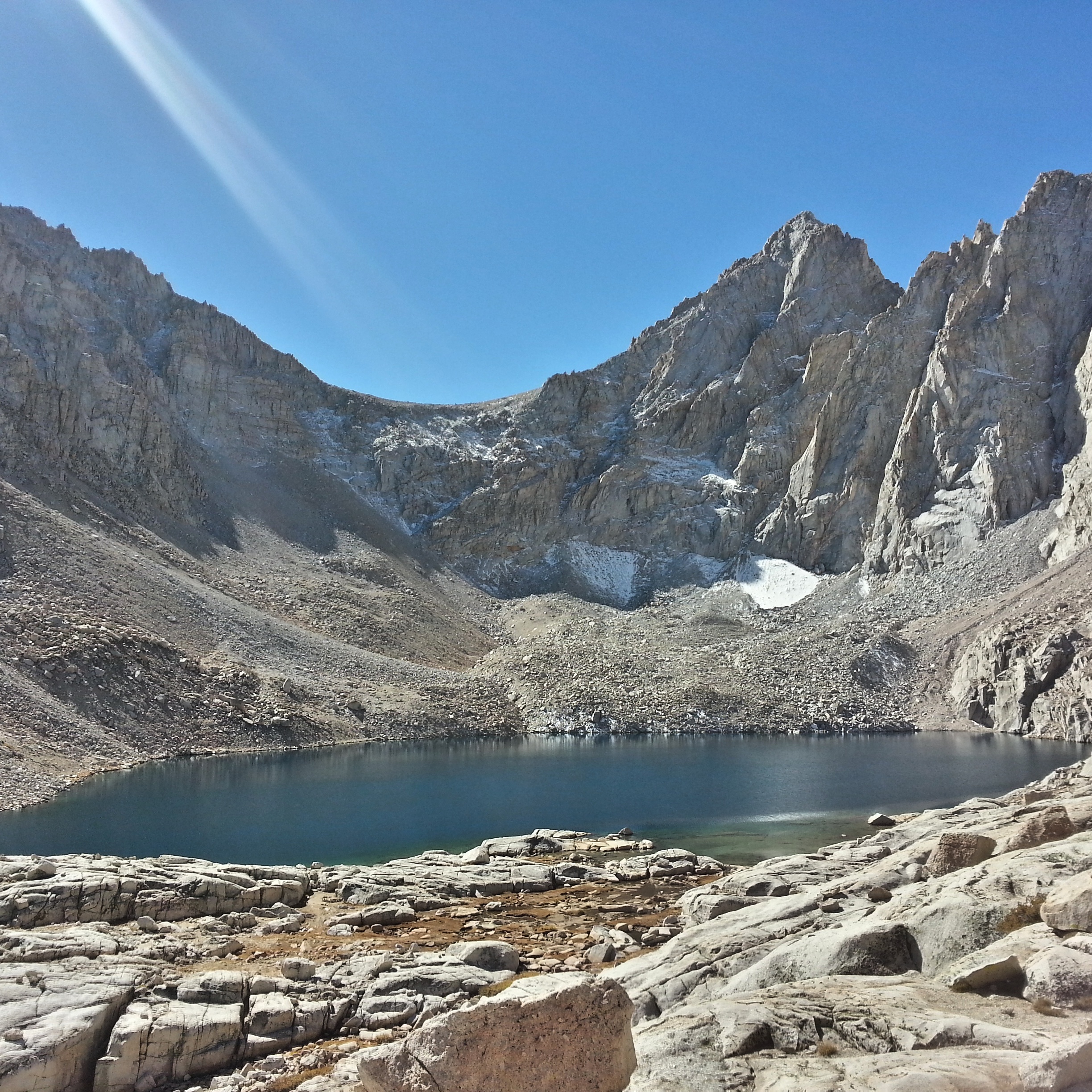
I meet up with Chance and Jess at the PCT junction and we sit against the granite, looking out at guitar lake and the peaks rising up opposite, a bit of weather rolling in on the horizon. I eat potato chips and pass around a bag of gin-gins- it’s so beautiful here it takes my breath away. Chance is feeling the altitude, too, and we climb the last mile together, stopping often and laughing and comparing everything to how it looked in spring, still crusted in ice and snow. Jess, of course, is fine, like she always is- unaffected by altitude, or climbing, or fatigue, or hunger, or thirst. Hiking with Jess is inspiring to me, and good for my morale- she makes everything seem so damn possible.
the saccharine paradise of Muir
.

Chance is tuff
.
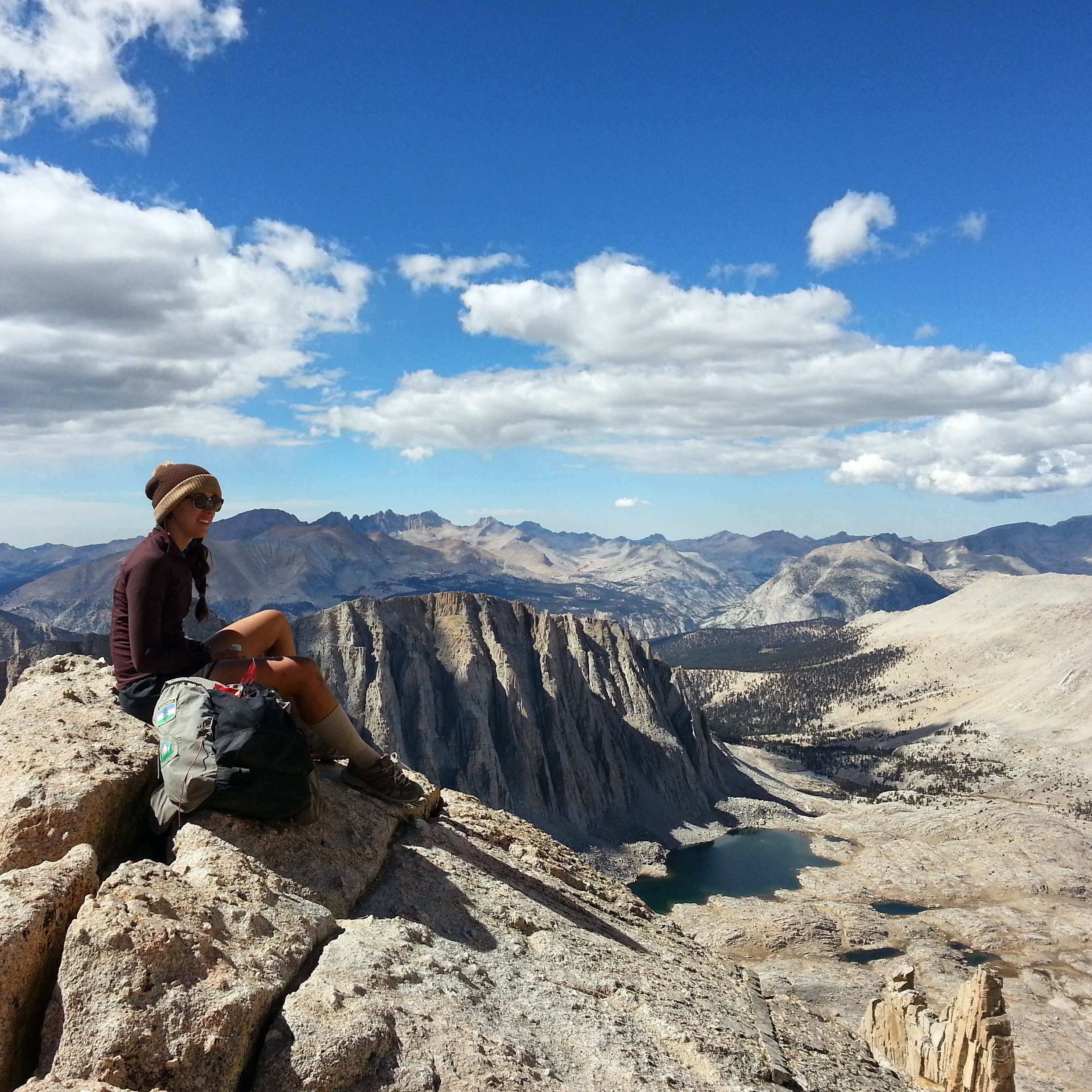
Jess just casually bein a babe
We reach the summit block at mid-day- it’s cold up there and clouds are really rolling in now, threatening snow. My head feels crazy from the altitude up here at 14,450 feet and I’m out of water- I want to rush down, back to the campground, get a hitch into Lone Pine and collapse at LoveNote’s house. But I’m also right now in this special high-up world and we jump around a little bit, look out at the great convoluted earth, talk to the other people on the summit. We did it, we did it, we did it! We made it to the top of Mt. Whitney!

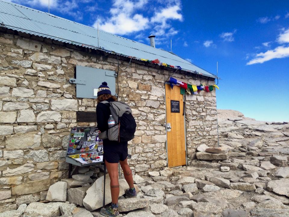
summit hut
“Five days nineteen hours,” I say. “What is that, like, an FKT?” It’s funny to think about claiming an FKT for something like the L2H, which is a route only a handful of people have ever done. Why not, though? We joke about messaging our friend Bobcat, asking how long it took him to do the route in spring. But they took the mountaineering route up Mt. Whitney, clawed their way to the summit block with ice axes. It’s not really the same.
yours truly
I stand on the summit block and remember being here in May this year, how warm and sunny it was, all of us in our t-shirts. Eating all our snacks, famished. Laughing, feeling drunk from the altitude. Jess, Chance and I make a tiny human pyramid and a woman we just met takes our picture. The picture is silly, not like a pyramid at all- it looks as though we’re ponies and Jess is riding us.
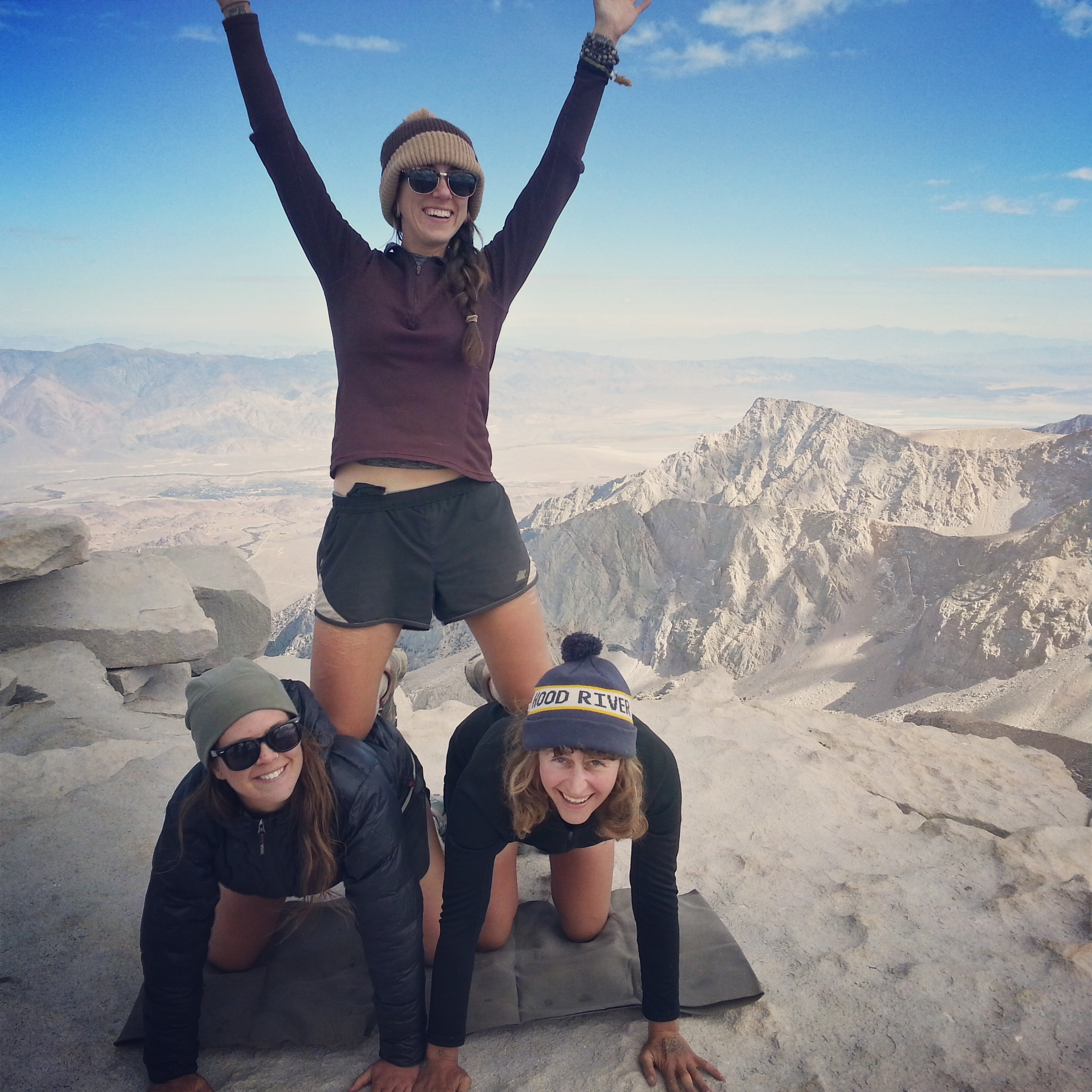
Well. We tried.
We laugh about this and then Chance and I head down- it’s just barely begun to snow. Jess hangs back, wanting a little more time on the summit. As we descend our heads grow clearer, the pounding begins to retreat. We reach a little lake and fill up our water and Jess catches us- she was jogging down the icy switchbacks, swinging around every hairpin.
“It’s really snowing up there!” she says.
“Imagine if you lived in Lone Pine,” I say. “You could come up here every day. You could, like, run up Mt. Whitney, every day.”
Jess’ eyes look dreamy.
“Yeah,” she says.
The hike down seems to take forever and I think about food, about sleep, about the long journey ahead of us back to Southern Oregon. We pass a group of younger dudes from the bay area, wearing fashionable clothes and resting against a log, eating snacks.
“Are you guys headed into Lone Pine?” I say. “We’re looking for a ride from the campground. If you’ve got room.”
“Yeah,” they say. “Sure.”
“I’ll buy you Carls Jr.,” I say.
“Deal,” they say.

L2H YAY
———-
Completing our journey was only possible with the support of many people. THANK YOU to everyone who picked us up on our hithchike south, to LoveNote and Burly and Huckleberry for hosting us in Lone Pine in their enchanted bungalow and ferrying us northward and then hosting us AGAIN in their dreamy cabin, and to the trail angel Badfish who met us in a Tahoe casino and literally drove us all the way back to Ashland. And thanks to all my Instagram followers for their tips and logistical help. Thanks to Brett “Blisterfree” Tucker for creating the route, and the maps, and to Charlie (wherever you are) for being, like, a cowboy (if that’s what you are) and wandering the dry mountains on your wild burro, or whatever, and checking to see if the water sources are running. And thanks to Chance and Jess, without whom I would’ve surely gone mad.
Many more photos of this journey can be found on my Instagram.

A totally awesome post! Great photos and a great write up.
Thank you for another wonderful trip report. You prove with each adventure that “all things are possible”. Best wishes on the Florida Trail. I can hardly wait to hear about it.
#BlackLivesMatter
Carrot, I have enjoyed your hiking trip posts. And everything else you have posted here.
Be cool, be safe, and thanks,
Mike M
Many small things become one large thing. That is so awesome.
Thoroughly enjoyed following along with this series. Thank you so much for sharing.
I just read through all of the L2H posts. It was perfect, thank you.