(In the first week of October, 2014, I set out to hike the Lowest to Highest Route with NotaChance and Orbit. This is the fourth installment of my trip report. For technical information on this route, go here.)
———————————
None of us really sleeps, although it’s not for lack of trying. It’s just so enchanting here, lying on my foam pad in the cool dappled shade of this black cottonwood tree, this single solitary tree in the wide, sun-baked, rubbly, desert. What miracle, this tree! The tree whispers of ghosts, describes dramas with its branches. Speaks of unrequited love, despair, other stories. The shade works its way slowly across the dirt and I can hear the gentle clatter of the cottonwood leaves. The bright-orange goldfish follow Chance around the perimeter of the spring-fed pond, hoping to get fed. She squats, fills her bottles, and then gives them some pretzels. I close my eyes, time passes, and when I open them Chance is smoking a cigarette.
“What time is it?” I say.
Jess is packing up her bag.
“Four-thirty,” says Chance.
“Shit!” I say.
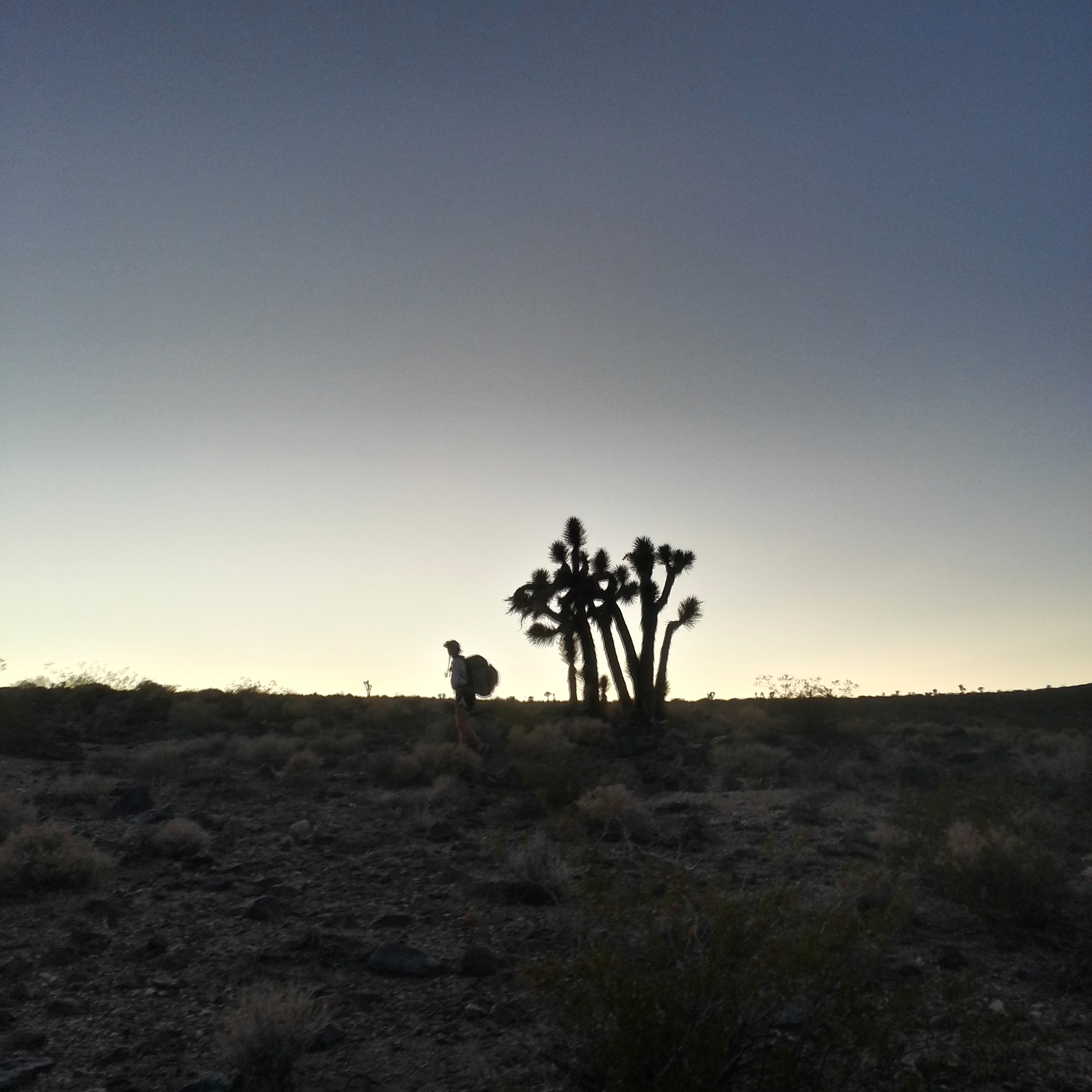
Beyond the shade of the cottonwood tree the hot sun still pulses in the empty sky but for a while we’re working our way up a wash that’s shaded on both sides by walls of rock, and it’s cool and dim. The walking is easy and then we’re climbing cross-country up gentle Darwin Flats, the ground pocked with tarantula holes, the sun lengthening behind us turning the Panamints pink and orange.

so furry!
.

Chance on Darwin Flats
The land is open and unobstructed, the going is straightforward. The sun sinks and then flames behind the joshua trees before going out entirely, leaving only the moon.
Jess
The moon is all we need to make our way, though, across this wide landscape, and in the distance we can see the thin line of the highway, the lights of passing cars. Highway 190- that’s where our water cache is. The stars wink on above the black crest of the Inyo Mountains and I check my GPS, choose a starlit peak, and aim for it. Around me somewhere in the desert are Jess and Chance, sometimes swallowed by the darkness, sometimes not. Occasionally I’ll stop and stand, wait to see the pale light of someone’s desert shirt in the moonlight.
We reach the highway at 7 p.m. and just beyond it is our cache, still intact, six gallons of water hidden with dirty scraps of cloth and hunks of rock. The highway is black and lonely, the desert vast, the stars warm and bright above us.
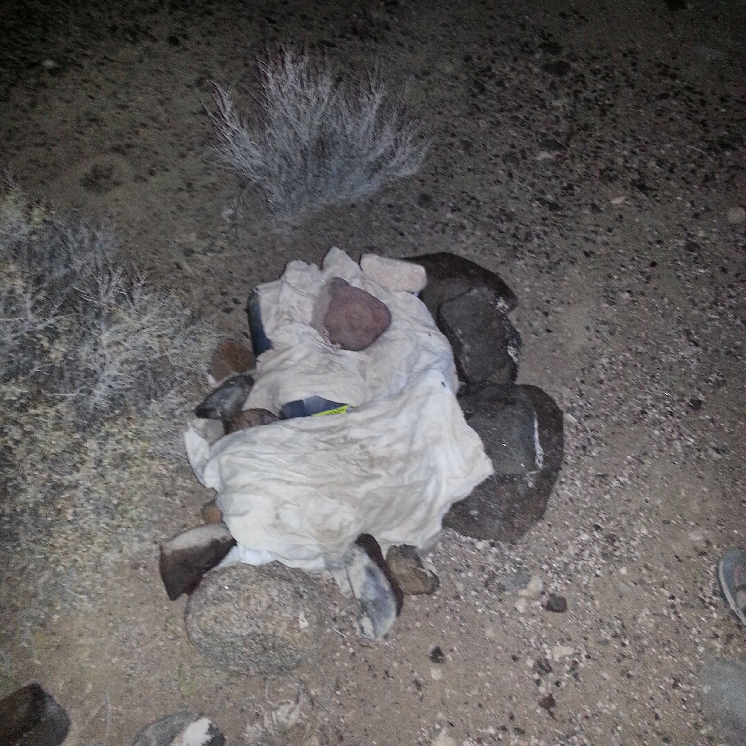
Cache
We sit in the dirt and Jess boils water for instant coffee. The next 45 miles to Lone Pine, which includes a long climb up and over the Inyo mountains in the heat, has no water. How much water should we carry out of our cache? We don’t know.

Jess makes coffee
In the end we all take around 6 liters and set out at 8 p.m. across the desert on a dirt road, the milky way diffuse above us. The road is flat and easy and we walk quickly, even though our packs are heavy with all the water. We can walk side by side, here, and we do, talking and falling silent, fiddling and doing this or that. Chance blasts music on her phone and I make shadow puppets in the moonlight, which makes Jess laugh. I should be tired after the last few nights of short sleep but I don’t feel weary yet. I’m still riding the endorphins, the adrenaline, whatever that thing is that adventure gives you that makes you feel alive, as though your regular ordinary world has been replaced by one in which anything can happen.
It’s just after midnight when we see it- two parallel white lights, like wingtips of a plane, slowly rising up the western horizon. We stop and stare. There is no sound.
“Those aren’t stars,” I say.
“No,” says Jess.
The lights move farther up the dark sky and then they slowly fade away.
“Holy fuck,” says Chance.
“UFO!” I say. I whirl around, but the road behind us is empty. The desert is suffused with an eerie stillness. I think of a radio show I once listened to about UFO’s- they found dead cows in the desert, their mouths cut out with lasers.
We are all very creeped out now. We walk on down the pale dirt road, past the sentinels of Joshua trees. We’re weary, and we try and decide what to do- do we walk until dawn, or for another few hours? I think I can go until dawn but at the same time something inside of me is unspooling, some tightly wound excited thing- coming open like a bunch of ribbon. I’m ready to lay inert in the sand, under the spinning stars. In the end we walk for another hour and then at one a.m. spread our bedrolls on the ground, collapse into them without dinner. I drink some water. My mouth tastes acidic, like night-time coffee. The ground is flat and hard and my spine opens into it. The alarm is set for 6 a.m.
Sleep.

Finally! I have been waiting and waiting, hoping you would post. I love your writing so much. It is so worth the wait. Thank you many times over for sharing what you do.
Love, as always.
I too say Fianlly, as I have been waiting and hoping you would post. As I grow impassionately waiting day after day, I wonder if you all made it out alive, but I know you already have. I just read it as if it is current and though I hate waiting, it’s worth it. Thanks Carrot
Carrot, I’m hoping that you don’t feel resentment over our (your humble readers) apparent sense of “entitlement” to your wonderful posts. It’s just that, as we read along, and see that it’s coming to a close, we begin to chant “no, no, there must be more!”.
What ungrateful people we are. Yes?
Looking so forward (with love!) to your next post.
More great stuff!
Thank you
Carrot, Your writing continues to blossom with an element of thrill. Thanks for sharing..
Sent from my Windows Phone ________________________________
I love that beautiful area. Your writing certainly does it justice…
Best regards,
Blaze
and yes, patiently [not so] waiting on chapter 5.
Pingback: Lowest to Highest, a Backcountry Route From Badwater to Mt. Whitney, Part Four- UFO | CARROT QUINN | Tjamrog's Weblog
UFO sighting are not that uncommon. Then again, you were (as the crow flies) now far from a Military Research and Development Installation. China Lake Naval Air Weapons Station.